

I'm happy to see so much progress! And thank you so much for your photos!!!!
So let's see your water data (update 5th May) :
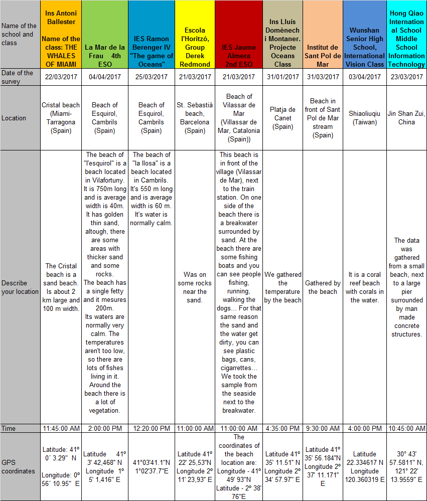


The order of participating schools is from West to East so we can all follow easily the changes in your data.
Ups! I'm afraid that IES Jaume Almera has got a bit confused with the coordinates. Could you send the corrected ones please? (Just leave a comment on this post. Thanks!)
Oh! And the students of the Wunshan Senior High School have sailed to another island, NICE! Did you enjoy the trip?
Hmmmm... I'm also sorry to see that Wunshan Senior High School had problems retrieving the satellite Sea Surface Temperature (SST) data from NASA's webpage. I'll send further information to your teacher if you want to give it another try!
And YES!!!!! I agree with you that there's just one ocean interconnected.
Ok, now let me ask you a couple of questions:
1. Can you tell why the temperature gathered by the Ins Domènech i Muntaner is much lower than neighbouring schools?
2. None of you coincide with the years of major and minor SST oscillation. Knowing that the sea has a great influence on the climate, do you think that the climate change is going to be the same around the world?
You can leave your answer using the comment option of the post. Students can also participate individually!
Cheers!
Sharky
Hello we are Ins Jaume Almera. We are sorry for the mistake.
ReplyDeleteThe correct coordinates are these:
Latitude - 41º 49' 93" N
Longitude - 2º 38' 76" E